Fan-Shaped Educational Maps: World Geography and Panoramic Map of Kyoto
(扇面図 地理教育図と京都市街図, Senmenzu chiri kyōiku-zu to Kyōto shigaizu)
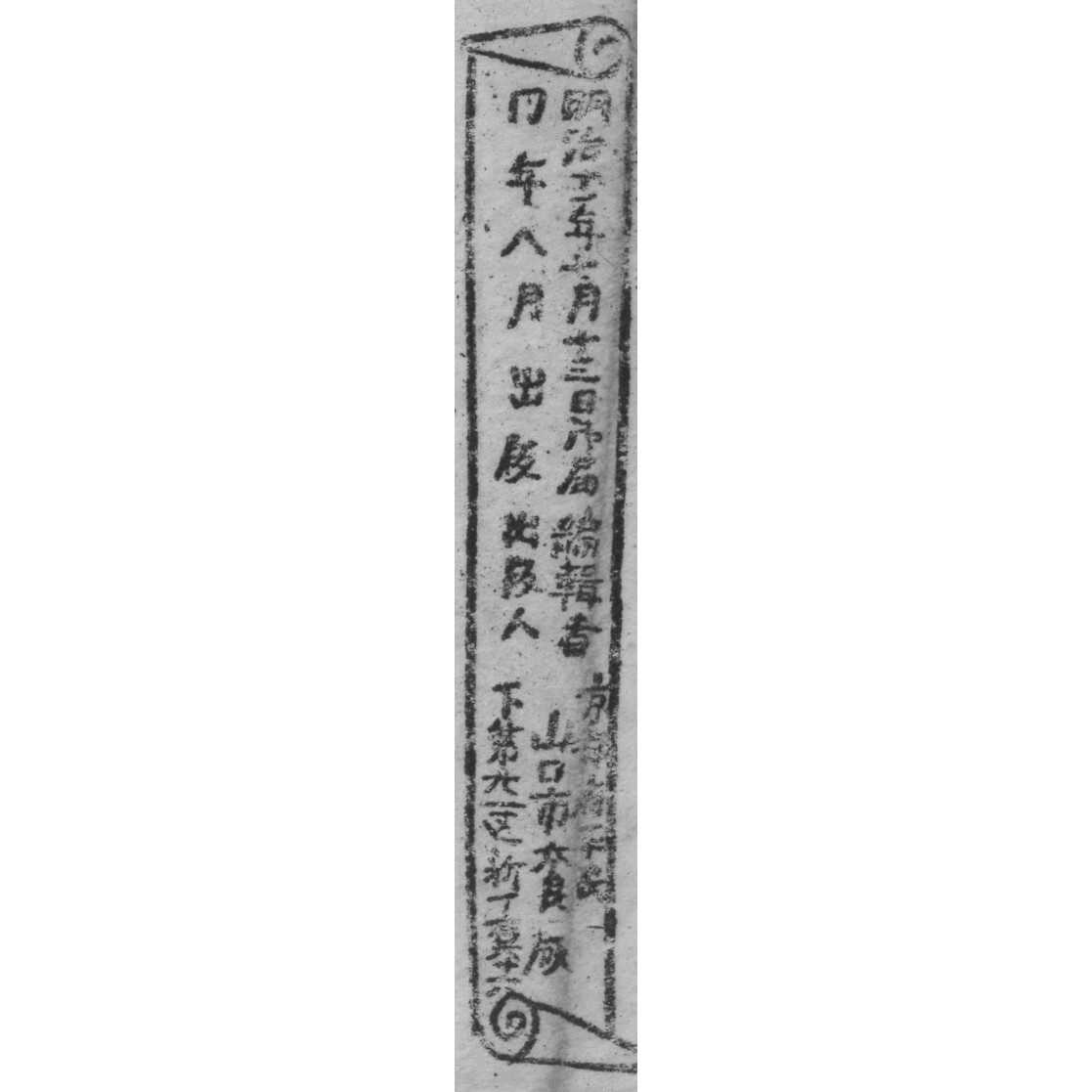
Date: August 1873 (Meiji 6).
Media: Woodblock prints on paper, fan-shaped format (扇面図, senmenzu) intended for folding fans (ōgi, 扇)
Black ink on thin paper; unmounted; each design composed in radial format with text or imagery in concentric arcs
Place of Publication: Yamaguchi City, Honmachi, Shimo-Konya-chō 1-chōme
Publisher/Editor: Ōhashi Yahei (大橋弥兵衛), listed as 編輯者 (editor)
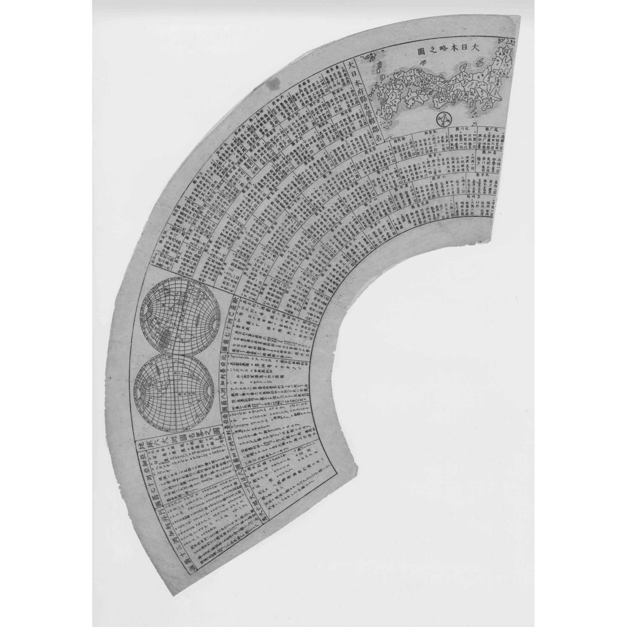
1. Quick Reference Map of the Earth’s Continents and Country Names
(地球大洲国名早見之図, Chikyū taishū kokumei hayami no zu)
Educational reference fan print featuring:
-
Double-hemisphere world map (Eastern and Western Hemispheres)
-
Radiating text listing country names by continent
-
Simplified map of Japan at upper right (Dai Nipponkoku ryaku no zu, 大日本国略之図)
-
Additional blocks with astronomical, calendrical, and cosmological data
-
List of feudal domains (藩), showing use of pre-abolition han system
- Dimensions: 155 x 470 mm
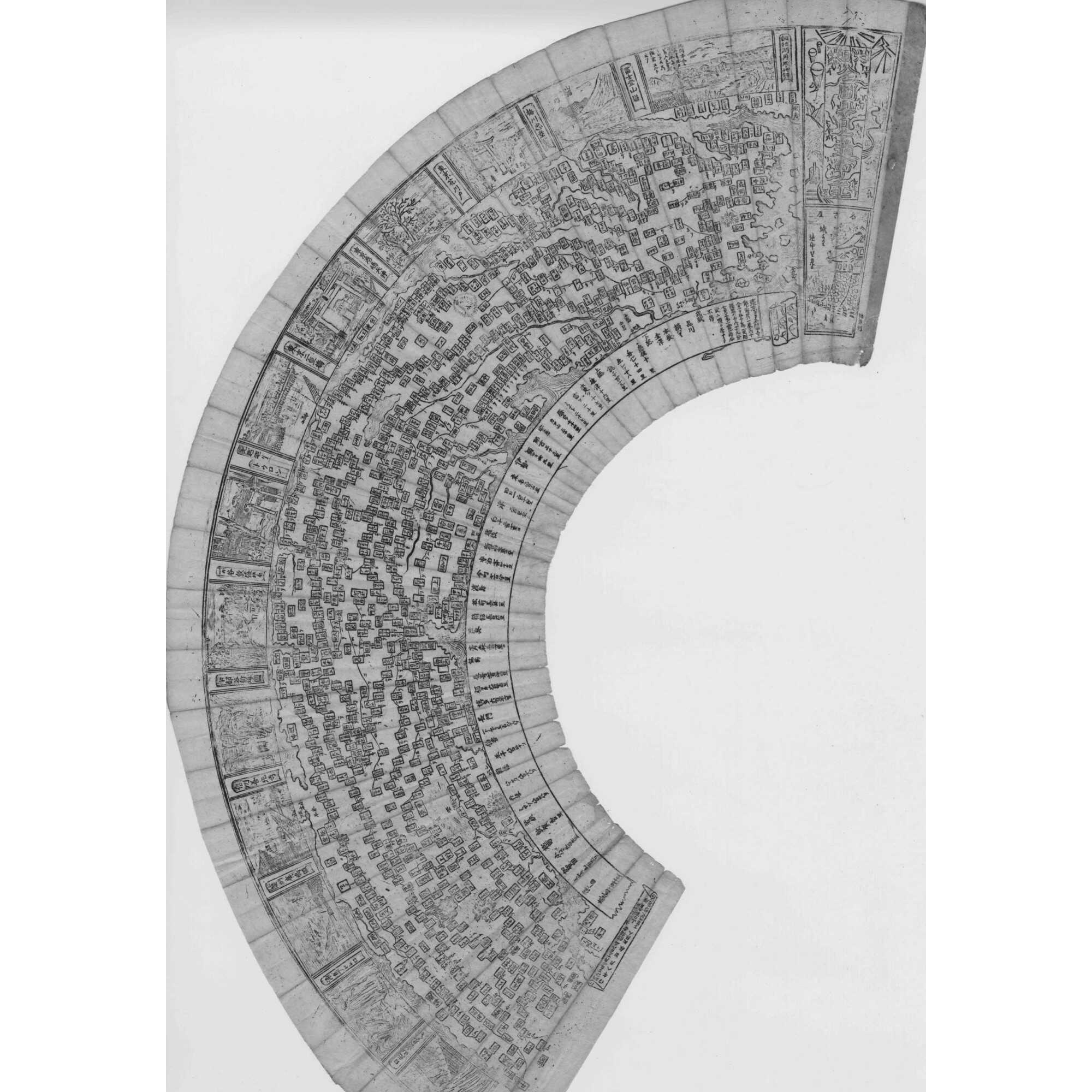
2. Panoramic Map of Kyoto
(京都名所市街図, Kyōto meisho shigaizu)
Bird’s-eye depiction of central and western Kyoto, centered on the Kamo River (賀茂川). Features include:
-
Notable locations: Imperial Palace, Gion, Kinkaku-ji, Arashiyama, Sanjo Bridge
-
Top register: framed meisho (名所) scenic panels of famous landmarks
-
Bottom arc: textual directory of neighborhoods and sites
- Dimensions: 160 x 515 mm
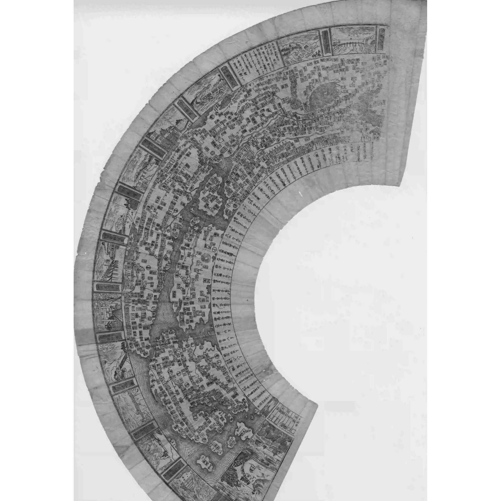
3. Panoramic Map of Kyoto
(京都名所市街図, Kyōto meisho shigaizu)
Continuation of the Kyoto map, covering eastern and southern districts. Key features:
-
Landmarks: Fushimi Inari, Tofuku-ji, Mount Hiei, Uji, Shugakuin
-
Decorative vertical cartouche at upper right
-
Publisher’s imprint in lower margin confirms publication in August 1873 by Ōhashi Yahei in Yamaguchi City
- Dimensions: 150 x 505 mm
Interpretation:
This set of three coordinated senmenzu combines global perspective with local cartographic pride, reflecting both rangaku-inspired educational reform and traditional urban geography. The consistency in layout, paper, block style, and publishing data supports the conclusion that they were planned and issued as a unified set in 1873, not separate sheets from different projects.
Such fan-shaped educational prints were likely intended as instructive yet decorative tools for students or curious readers, blending practical geography with cultural reverence for Kyoto as Japan’s historical capital.
Additional Information
| Collection | Japanese prints and drawings |
|---|---|
| Type / Purpose | Woodblock print |
| Period | 18 AD , Meiji era [明治] (1868–1912) , Mid-19th century |
| Country | Japan |
| Subject | Early maps , Education , Fan , Fan print , Geography , Japan , Japanese history , Japanese woodblock prints , Kyoto (Japan) , Maps , World atlases |
| Media/Technique | Ink , Paper , Woodblock print |
| Creation / Publishing year | 1873 , Meiji 6 |
| Acquisition year | 2021 |
