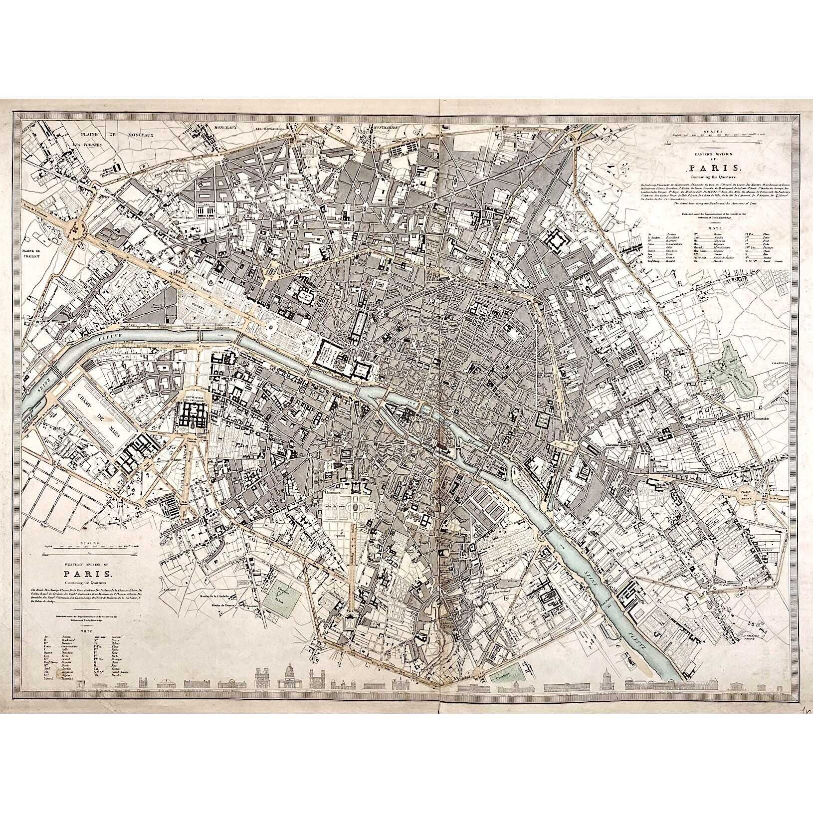
Top right: EASTERN DIVISION OF | PARIS. | Containing the Quartiers | {5 lines in italic} | Published under the Superintendence of the Society for the | Diffusion of Useful Knowledge ||
Bottom left: WESTERN DIVISION OF | PARIS. | Containing the Quartiers | {4 lines in italic} | Published under the Superintendence of the Society for the | Diffusion of Useful Knowledge ||
The map is framed, but there is no lettering beneath the frame to identify the cartographer, engraver, and publisher. However, we can attribute it to William Barnard Clarke (British, 1806 – 1865) and John Shury (fl. c. 1814-1844). The publisher is either Baldwin & Cradock or Chapman and Hall.
Dimensions: Sheet: 40 x 60.8 cm; Image: 40 x 53.5 cm.
Additional Information
| Collection | European prints and drawings |
|---|---|
| Type / Purpose | Map |
| Period | 19 AD , Mid-19th century |
| Country | Great Britain |
| Language | English |
| Subject | Cities and towns , City , Early maps , Paris , Physical maps , World atlases |
| Material | Wove paper |
| Media/Technique | Copperplate engraving , Hand-colouring |
| Creation / Publishing year | 1840 |
| Acquisition year | 2021 |
Related Items


SVVP-0076.2021
Eastern division of Paris. — Edward Stanford, c. 1870.

SVVP-0073.2021
The environs of Paris. — London: Baldwin & Cradock, 1832.

SVVP-0083.2021
The Environs of Paris. — London: Charles Knight & Co., 1844.

SVVP-0081.2021
Galignani's plan of Paris, 1827

SVVP-0074.2021
A plan of the city of Paris. — London: J. Stockdale, 1800.
