-
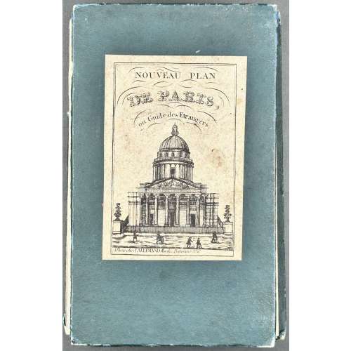 NEWA folding pocket map of Paris, 620 x 890 mm, hand-coloured, folded size: 168 x 102 mm. A high-quality image at Wikimedia Commons. Description by seller: "Contours des arrondissements et mur des fortifications aquarellés. Les arrondissements nouvellement annexés ne sont pas reproduits à l'échelle. Avec indication en bleu des percements haussmaniens en cours. Deux panoramas gravés en marge". Label: NOUVEAU PLAN | DE PARIS, | ou Guide des Étrangers. | {Panthéon} | A Paris chez LALLEMAND Rue de Poitevins No. 6. Title: NOUVEAU PARIS [—] FORTIFIÉ 1860. || PLAN GARANTI~COMPLET | OU | LE GUIDE DAN PARIS | DRESSÉ | PAR LALLEMAND, GÉOGRPHE. GRAV. AU DÉPOT DE LA GUERRE | 1860 | A Paris Rue de Poitevins No. 6. Engraver: Dépôt de la guerre Publisher/Cartographer: Lallemand, Armand Joseph (French, c.1810 – 1871)
 -
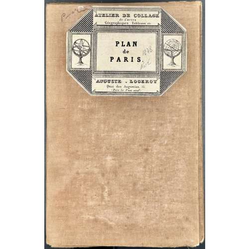 NEWA jigsaw pocket map of Paris, 763 x 1086 mm, coloured, 36 segments on a canvas base; folded size: 190 x 125 mm. A high-quality image at WikipédiA. Reference: "An extremely large 1878 pocket of Paris by A. Logerot. It covers the walled centre of Paris and its immediate vicinity, including the Bois de Boulogne and Bois de Vincennes. All streets and many important buildings are noted throughout. Colour-coded by arrondissement. All text is in French. This map was first issued by Logerot in 1859 and updated annually through the 1880s. This is the 1878 edition drawn by Ch. Smith". [Geographicus Rare Antique Maps] Label: ATELIER DE COLLAGE | de Cartes | Géographiques Tableaux etc. | PLAN | de | PARIS | AUGUSTE • LOGEROT | Quai des Augustins, 55. | (Près le Pont neuf) || Top : NOUVEAU PLAN DE PARIS DIVISE EN 20 ARRONDISSEMENTS. | Dans un rayon de 10 kilomètres. | PUBLIÉ PAR AUG. LOGEROT, ÉDITEUR. [—] PARIS, QUAI DES AUGUSTINS, 55. Bottom centre :1878, Right : IMP. MONROCQ, PARIS. Description: Entoilage beige de l’époque, 36 segments. Arrondissements, forts et fortifications en couleurs. Contributors: Logerot, Auguste (French, fl. c.1839 – c.1880) Monrocq, Jean Noël (French, 1819 – 1913) Imprimerie Monrocq (Paris)
 -
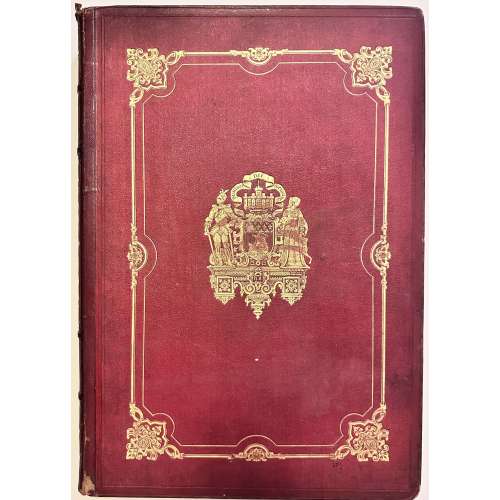 NEWThree volumes, hardcover in-folio, 495 x 350 mm, 1st edition, uniformly bound in red faux-chagrin with gilt coat of arms of the city of Paris in the centre of gild-decorated panel, gilt decorated spine with lettering, marbled endpapers, 3 vol. (122 p.-[46] pl., 76-44-24-22-36-26...); vol. 1 – 340 pp, vol. 2 – 296 pp, vol. 3 – 268 pp ; total 100 leaves of plates. Title-page (red and black): PARIS | DANS SA SPLENDEUR | MONUMENTS, VUES, SCÉNES HISTORIQUES, DESCRIPTIONS ET HISTOIRE | DESSINS ET LITHOGRAPHIES | […] | VIGNETTES DE FÉLIX BENOIST ET CATENACCI, EXÉCUTÉES SUR BOIS PAR LES PREMIERS GRAVURS | TEXTE | […] | Premier Volume (Deuxième Volume, Troisième Volume) | PREMIERE PARTIE. — DESCRIPTION DE PARIS | {vignette} | Publié par | HENRI CHARPENTIER, IMPRIMEUR-ÉDITEUR | PARIS, QUAI DES GRANDS-AUGUSTINS, 55. — ÉTABLESSEMENT A NANTES, RUE DE LA FOSSE. | M. DCCC. LXI. || Contributors: Mérimée, Prosper (French, 1803 – 1870) – text Viollet-le-Duc, Eugène (French, 1814 – 1879) – text Audiganne, Armand (French, 1814 – 1875) – text Philippe Benoist (French, 1813 – 1896) – lithography Benoist, Félix (French, 1818 – 1896) – woodcuts Catenacci, Hercule Louis (French, 1816 – 1884) – woodcuts Charpentier, Henri-Désiré (French, 1806 – 1882) Henri Charpentier imprimeur (Nantes) – printer Henri Charpentier éditeur (Paris) –publisher
 -
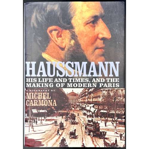 Hardcover, 242 x 168 mm, quarter burgundy cloth over blue paper boards, outer edge untrimmed; pp.: [6] [1-4] 5-516 [2 colophon/blank] [6 blanks]. First published in France in 2000 as “Haussmann” by Librairie Arthème Fayard. Title-page: HAUSSMANN | ~ | His Life and Times, | and the Making of Modern Paris | MICHEL CARMONA | TRANSLATED FROM THE FRENCH BY PATRICK CAMILER | {publisher’s device} | Ivan • R • Dee | Chicago 2002 || Michel Carmona (French, b. 1940) Georges-Eugène Haussmann [Baron Haussmann] (French, 1809 – 1891)
 -
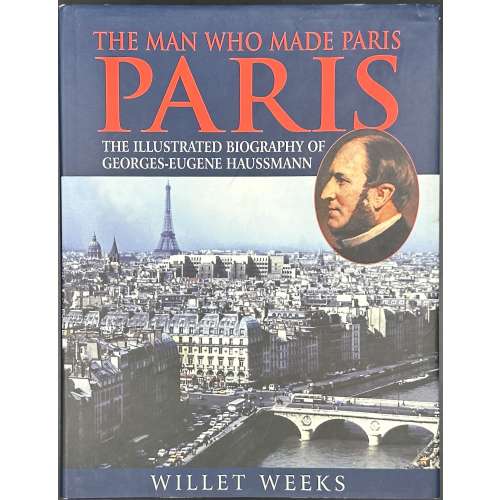 Hardcover volume, 25.3 x 19.6 cm, bound in blue cloth, gilt lettering to spine, pictorial dust jacket, crimson endpapers, pp.: [1-4] 5-160, ils. Title-page: THE MAN WHO MADE PARIS | PARIS | THE ILLUSTRATED BIOGRAPHY OF | GEORGES-EUGENE HAUSSMANN | WILLET WEEKS | Photographer of | scenes of Paris today | JEAN-CLAUDE MARTIN | (in frame) LONDON / HOUSE || Contributors: Willet Weeks (American)– author. Jean-Claude Martin (French-American) – photographer. Georges Eugène Haussmann (French, 1809 – 1891) – character.
 -
 Brown cloth 24 x 15.5 cm, gilt lettering to front cover and spine, 'Cowles Library - Drake University' stamps inside and to edges, library card pocket to the pastedown, removed sticker to spine, top edge red, pictorial endpapers, pp.: [i-iv] v-xv [xvi], 1-372, total 388 pages; collated in-16mo: [1]-916 1018 11-1216, total 194 leaves plus four leaves of plates before gathering 6, four leaves of plates before gathering 9, and a folding map at the end, gathering 8 unsigned. Half-title: STUDIES IN URBAN HISTORY I | General Editor: H. J. Dyos | Reader in Urban History at the | University of Leicester || Title-page: The Autumn | of Central Paris | The Defeat of Town Planning 1850-1970 | Anthony Sutcliffe | Research Fellow in Modern History at the | University of Birmingham | {blank} | {publisher’s device} | Edward Arnold || ISBN: 9780713155495; 0713155493. OCLC Number / Unique Identifier: 1035744553. Contents: Introduction -- The Grand Design -- The Struggle to Complete the Imperial Plan -- The Period of Distractions -- Building in the Right Bank Centre, 1850 -- 1914 -- The Indian Summer of Central Paris -- The Battle for Preservation, 1850-1914 -- The Abandonment of the Grand Design -- The Approach of Obsolescence -- Victory for Preservation -- Conclusion -- Appendix I : Sources -- Appendix 2 : Graphs and Diagrams Anthony Sutcliffe (British, 1942 – 2011) – author. Harold James Dyos (British, 1921–1978) – general editor of the series.
 -
 Title-page: CURIOSITÉS | DE L’HISTOIRE | DU VIEUX PARIS | PAR | P. L. JACOB | BIBLIOPHILE | { LES NOMS DES RUES | LES RUES DE CITÉ | LES RUES HONTEUSES AU MOYEN AGE. | PROMENADES DANS LE VIEUX PARIS EN 1834. | PHYSIOLOGIE DU PONT NEUF. | BICÊTRE } | PARIS | ADOLPHE DELAHAYS, LIBRAIRE-ÉDITEUR | 4-6, RUE VOLTAIRE, 4-6 | – | 1858 || Description: Hardcover, in-16o, 17 x 11 cm, quarter brown morocco over marbled boards, spine with raised bands, gilt lettering, gilt fleurons, marbled endpapers, original wrappers with red and black lettering within red frame bound in, some pages uncut. Collation: 8vo; π2 14, 2-238 244, total 186 leaves between original wrappers. Pagination: [4] [1] 2-364 [4], total 372 pages. Catalogue raisonné: Vicar: I, 770. Contributors: Printer: Simon Raçon et Comp. (Paris). Author: Paul Lacroix [P. L. Jacob] (French, 1806 – 1884). Publisher: Adolphe Delahays (French, mid-19th century).
 -
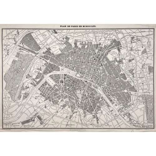 Above the frame: PLAN DE PARIS EN MDCCCLIII. Below the frame: Gravé par F. DELAMARE […] PARIS. TYP. DE FIRMIN DIDOT FRÈRES, 56, RUE JACOB. […] PANICONOGRAPHIE DE GILLOT. Q. ST. MICHEL 23. Dimensions: Sheet: 37 x 52.5 cm: Image: 33 x 50 cm. Technique: Photozincography Contributors: Ferdinand Théodore Delamare (French, fl. 1850 – 1889) – engraver. Firmin Didot Frères ; Firmin Didot (French, 1764 – 1836) – publisher. Firmin Gillot (French, 1819 – 1872) – printer.
 -
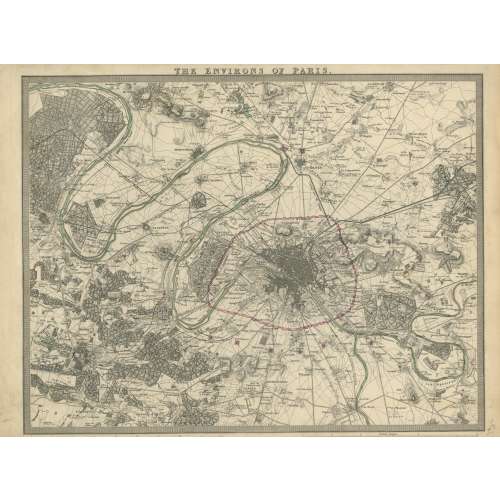 London: Published under the superintendence of the Society for the Diffusion of Useful Knowledge; Charles Knight & Co., no. 22 Ludgate Street. Dimensions: Sheet: 34 x 41.8 cm: Image: 28.7 x 38.3 cm. J. & C. Walker, Society for the Diffusion of Useful Knowledge Charles Knight & Co.; Charles Knight (British, 1791 – 1873) – publisher. J & C Walker (British firm, fl. 1820 – 1895) Walker, John (British, 1787 – 1873) Walker, Alexander (British, 1797? – 1870) Walker, Charles (British, 1799? – 1872) Society for the Diffusion of Useful Knowledge (SDUK) (British firm, 1826 – 1846)
 -
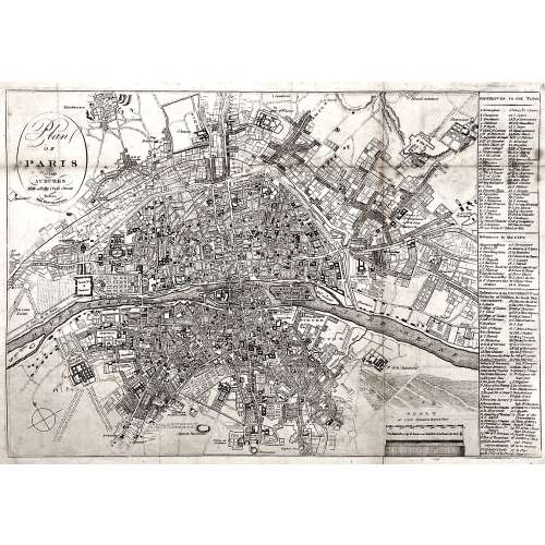 Oval cartouche in the upper-left corner, with tall “s”: Plan | OF | PARIS | and | SUBURBS | With all the Cross Streets | Before | THE REVOLUTION. || No indication of the makers. Dimensions: Sheet: 32.5 x 44.3 cm; Image: 28.5 x 41.3 cm.
 -
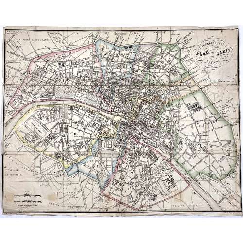 Upper right: Galignani's | PLAN OF PARIS | 1827 || in oval frame: Sauve sculpt. Bottom, under the frame: le Plan écrit par Lallemand. […] Gravé par E. Collin. Rue de la Harpe № 45. Dimensions: 36.5 x 46.5 cm. Armand Joseph Lallemand (French, c. 1810 - 1871) – cartographer. Charles-Étienne Collin (French, 1770 – 1840) – engraver. Étienne Collin II (French,1790 – 1852) – engraver. John Anthony Galignani (Italian, 1796 – 1873) – publisher. William Galignani (Italian, 1798 – 1882) – publisher.
 -
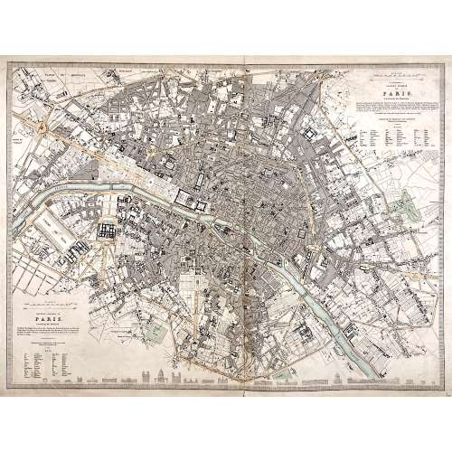 Top right: EASTERN DIVISION OF | PARIS. | Containing the Quartiers | {5 lines in italic} | Published under the Superintendence of the Society for the | Diffusion of Useful Knowledge || Bottom left: WESTERN DIVISION OF | PARIS. | Containing the Quartiers | {4 lines in italic} | Published under the Superintendence of the Society for the | Diffusion of Useful Knowledge || The map is framed, but there is no lettering beneath the frame to identify the cartographer, engraver, and publisher. However, we can attribute it to William Barnard Clarke (British, 1806 – 1865) and John Shury (fl. c. 1814-1844). The publisher is either Baldwin & Cradock or Chapman and Hall. Dimensions: Sheet: 40 x 60.8 cm; Image: 40 x 53.5 cm.
 -
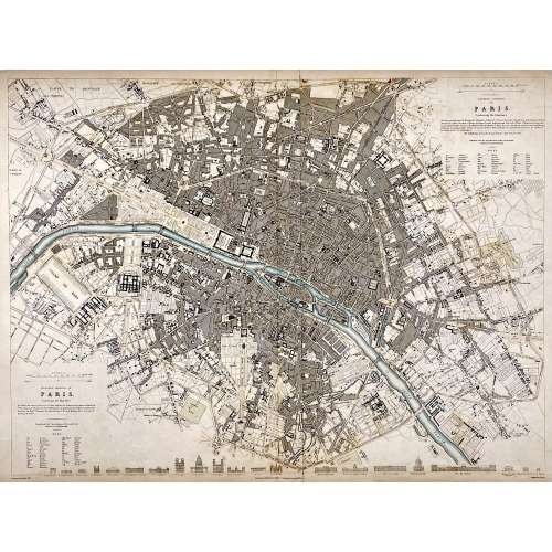 Top right: EASTERN DIVISION OF | PARIS. | Containing the Quartiers | {5 lines in italic} | Published under the Superintendence of the Society for the | Diffusion of Useful Knowledge || Bottom left: WESTERN DIVISION OF | PARIS. | Containing the Quartiers | {4 lines in italic} | Published under the Superintendence of the Society for the | Diffusion of Useful Knowledge || Under the frame: Drawn by W. B. Clarke, Archt. […] Published by Baldwin & Cradock, 47 Paternoster Row, A April 1st, 1834. [...] Engraved by J. Shury || Dimensions: Sheet: 40.8 x 57 cm; Image: 38.7 x 52.5 cm. Contributors: William Barnard Clarke (British, 1806 – 1865) – artist. John Shury (fl. c. 1814-1844) – engraver. Baldwin & Cradock (London) – publisher. Society for the Diffusion of Useful Knowledge (SDUK) (British firm, 1826 – 1846).
 -
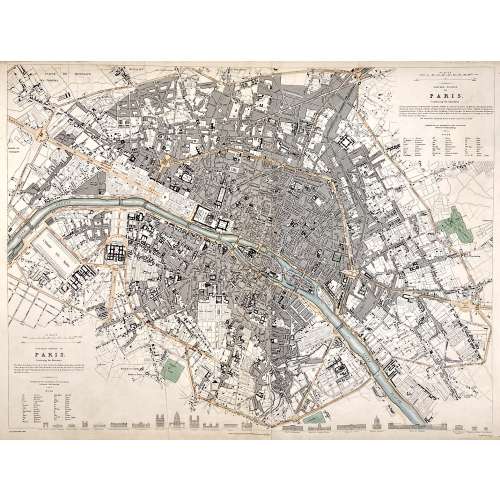 Top right: EASTERN DIVISION OF | PARIS. | Containing the Quartiers | {5 lines in italic} | Published under the Superintendence of the Society for the | Diffusion of Useful Knowledge || Bottom left: WESTERN DIVISION OF | PARIS. | Containing the Quartiers | {4 lines in italic} | Published under the Superintendence of the Society for the | Diffusion of Useful Knowledge || Under the frame: Drawn by W. B. Clarke, Archt. […] London: Published by Chapman and Hall, 186, Strand. April 1st, 1834. [...] Engraved by J. Shury || Dimensions: Sheet: 40.8 x 57 cm; Image: 38.7 x 52.5 cm. Contributors: William Barnard Clarke (British, 1806 – 1865) – artist. John Shury (fl. c. 1814-1844) – engraver. Chapman and Hall (London) – publisher. Society for the Diffusion of Useful Knowledge (SDUK) (British firm, 1826 – 1846).
 -
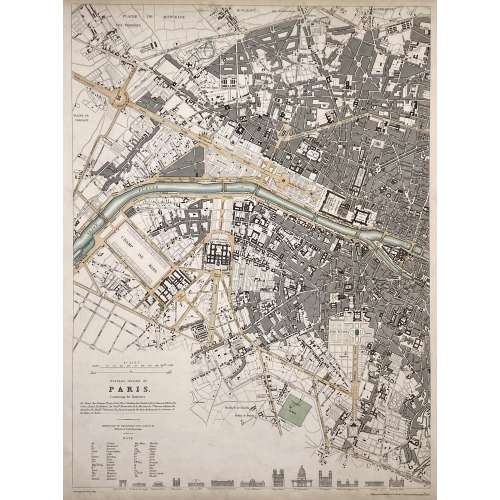 WESTERN DIVISION OF | PARIS. | Containing the Quartiers | {4 lines in italic} | Published under the Superintendence of the Society for the | Diffusion of Useful Knowledge || Under the frame: Drawn by W. B. Clarke, Archt. […] Published by Baldwin & Cradock, 47 Paternoster Row, April 1st. 1834. Dimensions: Sheet: 40.5 x 34.5 cm; Image: 39 x 28.8 cm. Contributors: William Barnard Clarke (British, 1806 – 1865) – artist. John Shury (fl. c. 1814-1844) – engraver. Baldwin & Cradock (London) – publisher. Society for the Diffusion of Useful Knowledge (SDUK) (British firm, 1826 – 1846).
 -
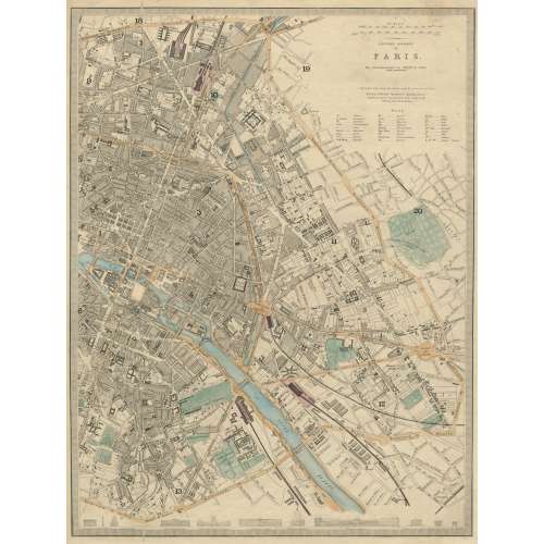 EASTERN DIVISION | OF | PARIS. | The Arrondissements are defined by colour | and numbered. || London, Edward Stanford 6 Charing Cross. | Published under the Superintendence of the Society for the Diffusion of Useful Knowledge. || Dimensions: Sheet: 43.5 x 35.5 cm; Image: 39.5 x 30 cm. Contributors: Edward Stanford (British, 1827 – 1904) – cartographer, engraver, publisher. Society for the Diffusion of Useful Knowledge (SDUK) (British firm, 1826 – 1846).
 -
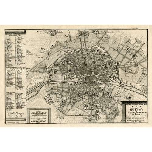 LE PLAN DE LA VILLE, | CITE, ET | UNIVERSITÉ | DE PARIS. | Capitale du Royaume | de France. | {5 lines in italic} | Par N. de Fer. | A Paris, | Chez l’Auteur dans l’Isle du | Palais a la Sphere Royale. | Avec Privilege du Roy. | 1705 | H. van Loon sculp. || Dimensions: Sheet: 27 x 39 cm; Image: 22 x 33 cm. Contributors: Nicolas de Fer (French, 1646 – 1720) – cartographer. Harmanus van Loon (Flemish, fl. c. 1690 – c. 1725) – engraver.
 -
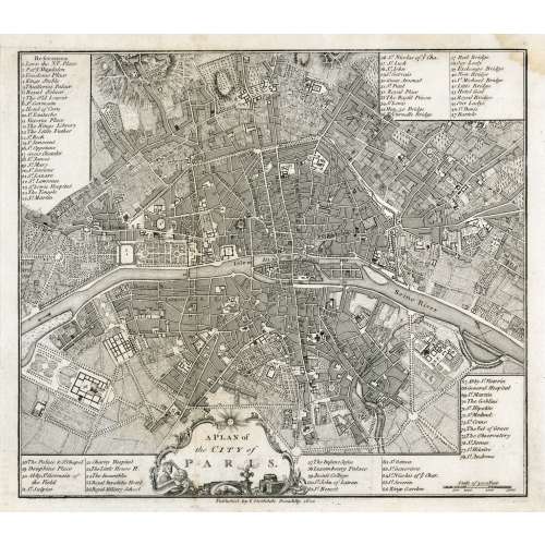 In pictorial frame: A PLAN of | the CITY of PARIS. || Under the border: Published by I. Stockdale Piccadilly 1800 || Dimensions: Sheet: 29 x 34.5 cm; Image: 22.7 x 25.9 cm.


