-
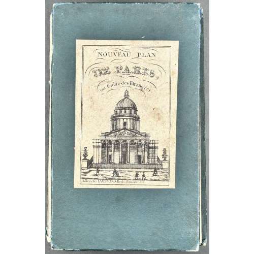 NEWA folding pocket map of Paris, 620 x 890 mm, hand-coloured, folded size: 168 x 102 mm. A high-quality image at Wikimedia Commons. Description by seller: "Contours des arrondissements et mur des fortifications aquarellés. Les arrondissements nouvellement annexés ne sont pas reproduits à l'échelle. Avec indication en bleu des percements haussmaniens en cours. Deux panoramas gravés en marge". Label: NOUVEAU PLAN | DE PARIS, | ou Guide des Étrangers. | {Panthéon} | A Paris chez LALLEMAND Rue de Poitevins No. 6. Title: NOUVEAU PARIS [—] FORTIFIÉ 1860. || PLAN GARANTI~COMPLET | OU | LE GUIDE DAN PARIS | DRESSÉ | PAR LALLEMAND, GÉOGRPHE. GRAV. AU DÉPOT DE LA GUERRE | 1860 | A Paris Rue de Poitevins No. 6. Engraver: Dépôt de la guerre Publisher/Cartographer: Lallemand, Armand Joseph (French, c.1810 – 1871)
 -
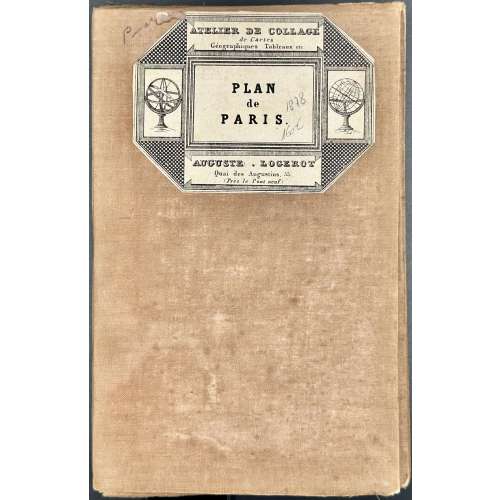 NEWA jigsaw pocket map of Paris, 763 x 1086 mm, coloured, 36 segments on a canvas base; folded size: 190 x 125 mm. A high-quality image at WikipédiA. Reference: "An extremely large 1878 pocket of Paris by A. Logerot. It covers the walled centre of Paris and its immediate vicinity, including the Bois de Boulogne and Bois de Vincennes. All streets and many important buildings are noted throughout. Colour-coded by arrondissement. All text is in French. This map was first issued by Logerot in 1859 and updated annually through the 1880s. This is the 1878 edition drawn by Ch. Smith". [Geographicus Rare Antique Maps] Label: ATELIER DE COLLAGE | de Cartes | Géographiques Tableaux etc. | PLAN | de | PARIS | AUGUSTE • LOGEROT | Quai des Augustins, 55. | (Près le Pont neuf) || Top : NOUVEAU PLAN DE PARIS DIVISE EN 20 ARRONDISSEMENTS. | Dans un rayon de 10 kilomètres. | PUBLIÉ PAR AUG. LOGEROT, ÉDITEUR. [—] PARIS, QUAI DES AUGUSTINS, 55. Bottom centre :1878, Right : IMP. MONROCQ, PARIS. Description: Entoilage beige de l’époque, 36 segments. Arrondissements, forts et fortifications en couleurs. Contributors: Logerot, Auguste (French, fl. c.1839 – c.1880) Monrocq, Jean Noël (French, 1819 – 1913) Imprimerie Monrocq (Paris)
 -
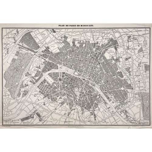 Above the frame: PLAN DE PARIS EN MDCCCLIII. Below the frame: Gravé par F. DELAMARE […] PARIS. TYP. DE FIRMIN DIDOT FRÈRES, 56, RUE JACOB. […] PANICONOGRAPHIE DE GILLOT. Q. ST. MICHEL 23. Dimensions: Sheet: 37 x 52.5 cm: Image: 33 x 50 cm. Technique: Photozincography Contributors: Ferdinand Théodore Delamare (French, fl. 1850 – 1889) – engraver. Firmin Didot Frères ; Firmin Didot (French, 1764 – 1836) – publisher. Firmin Gillot (French, 1819 – 1872) – printer.
 -
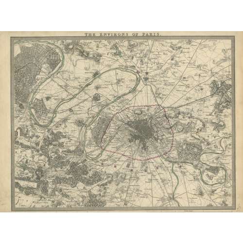 London: Published under the superintendence of the Society for the Diffusion of Useful Knowledge; Charles Knight & Co., no. 22 Ludgate Street. Dimensions: Sheet: 34 x 41.8 cm: Image: 28.7 x 38.3 cm. J. & C. Walker, Society for the Diffusion of Useful Knowledge Charles Knight & Co.; Charles Knight (British, 1791 – 1873) – publisher. J & C Walker (British firm, fl. 1820 – 1895) Walker, John (British, 1787 – 1873) Walker, Alexander (British, 1797? – 1870) Walker, Charles (British, 1799? – 1872) Society for the Diffusion of Useful Knowledge (SDUK) (British firm, 1826 – 1846)
 -
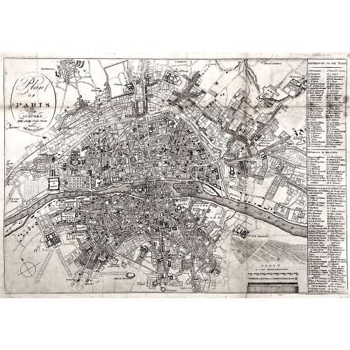 Oval cartouche in the upper-left corner, with tall “s”: Plan | OF | PARIS | and | SUBURBS | With all the Cross Streets | Before | THE REVOLUTION. || No indication of the makers. Dimensions: Sheet: 32.5 x 44.3 cm; Image: 28.5 x 41.3 cm.
 -
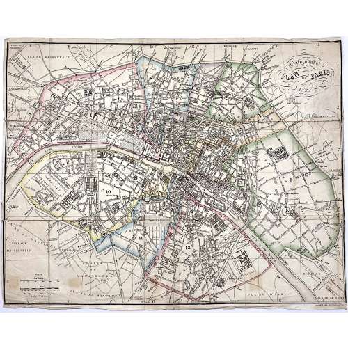 Upper right: Galignani's | PLAN OF PARIS | 1827 || in oval frame: Sauve sculpt. Bottom, under the frame: le Plan écrit par Lallemand. […] Gravé par E. Collin. Rue de la Harpe № 45. Dimensions: 36.5 x 46.5 cm. Armand Joseph Lallemand (French, c. 1810 - 1871) – cartographer. Charles-Étienne Collin (French, 1770 – 1840) – engraver. Étienne Collin II (French,1790 – 1852) – engraver. John Anthony Galignani (Italian, 1796 – 1873) – publisher. William Galignani (Italian, 1798 – 1882) – publisher.
 -
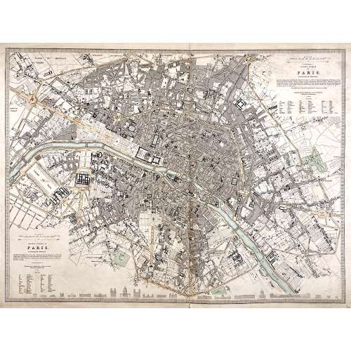 Top right: EASTERN DIVISION OF | PARIS. | Containing the Quartiers | {5 lines in italic} | Published under the Superintendence of the Society for the | Diffusion of Useful Knowledge || Bottom left: WESTERN DIVISION OF | PARIS. | Containing the Quartiers | {4 lines in italic} | Published under the Superintendence of the Society for the | Diffusion of Useful Knowledge || The map is framed, but there is no lettering beneath the frame to identify the cartographer, engraver, and publisher. However, we can attribute it to William Barnard Clarke (British, 1806 – 1865) and John Shury (fl. c. 1814-1844). The publisher is either Baldwin & Cradock or Chapman and Hall. Dimensions: Sheet: 40 x 60.8 cm; Image: 40 x 53.5 cm.
 -
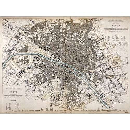 Top right: EASTERN DIVISION OF | PARIS. | Containing the Quartiers | {5 lines in italic} | Published under the Superintendence of the Society for the | Diffusion of Useful Knowledge || Bottom left: WESTERN DIVISION OF | PARIS. | Containing the Quartiers | {4 lines in italic} | Published under the Superintendence of the Society for the | Diffusion of Useful Knowledge || Under the frame: Drawn by W. B. Clarke, Archt. […] Published by Baldwin & Cradock, 47 Paternoster Row, A April 1st, 1834. [...] Engraved by J. Shury || Dimensions: Sheet: 40.8 x 57 cm; Image: 38.7 x 52.5 cm. Contributors: William Barnard Clarke (British, 1806 – 1865) – artist. John Shury (fl. c. 1814-1844) – engraver. Baldwin & Cradock (London) – publisher. Society for the Diffusion of Useful Knowledge (SDUK) (British firm, 1826 – 1846).
 -
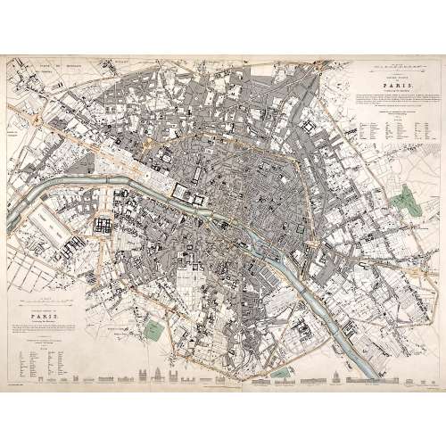 Top right: EASTERN DIVISION OF | PARIS. | Containing the Quartiers | {5 lines in italic} | Published under the Superintendence of the Society for the | Diffusion of Useful Knowledge || Bottom left: WESTERN DIVISION OF | PARIS. | Containing the Quartiers | {4 lines in italic} | Published under the Superintendence of the Society for the | Diffusion of Useful Knowledge || Under the frame: Drawn by W. B. Clarke, Archt. […] London: Published by Chapman and Hall, 186, Strand. April 1st, 1834. [...] Engraved by J. Shury || Dimensions: Sheet: 40.8 x 57 cm; Image: 38.7 x 52.5 cm. Contributors: William Barnard Clarke (British, 1806 – 1865) – artist. John Shury (fl. c. 1814-1844) – engraver. Chapman and Hall (London) – publisher. Society for the Diffusion of Useful Knowledge (SDUK) (British firm, 1826 – 1846).
 -
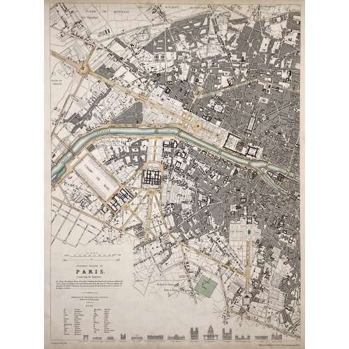 WESTERN DIVISION OF | PARIS. | Containing the Quartiers | {4 lines in italic} | Published under the Superintendence of the Society for the | Diffusion of Useful Knowledge || Under the frame: Drawn by W. B. Clarke, Archt. […] Published by Baldwin & Cradock, 47 Paternoster Row, April 1st. 1834. Dimensions: Sheet: 40.5 x 34.5 cm; Image: 39 x 28.8 cm. Contributors: William Barnard Clarke (British, 1806 – 1865) – artist. John Shury (fl. c. 1814-1844) – engraver. Baldwin & Cradock (London) – publisher. Society for the Diffusion of Useful Knowledge (SDUK) (British firm, 1826 – 1846).
 -
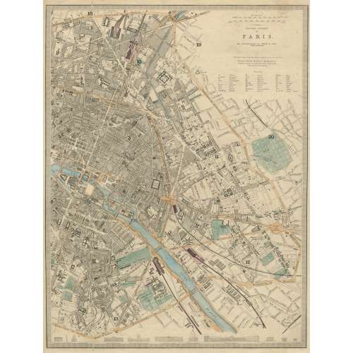 EASTERN DIVISION | OF | PARIS. | The Arrondissements are defined by colour | and numbered. || London, Edward Stanford 6 Charing Cross. | Published under the Superintendence of the Society for the Diffusion of Useful Knowledge. || Dimensions: Sheet: 43.5 x 35.5 cm; Image: 39.5 x 30 cm. Contributors: Edward Stanford (British, 1827 – 1904) – cartographer, engraver, publisher. Society for the Diffusion of Useful Knowledge (SDUK) (British firm, 1826 – 1846).
 -
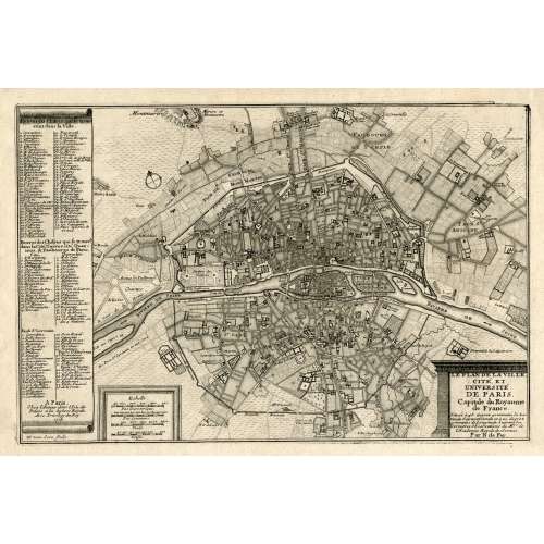 LE PLAN DE LA VILLE, | CITE, ET | UNIVERSITÉ | DE PARIS. | Capitale du Royaume | de France. | {5 lines in italic} | Par N. de Fer. | A Paris, | Chez l’Auteur dans l’Isle du | Palais a la Sphere Royale. | Avec Privilege du Roy. | 1705 | H. van Loon sculp. || Dimensions: Sheet: 27 x 39 cm; Image: 22 x 33 cm. Contributors: Nicolas de Fer (French, 1646 – 1720) – cartographer. Harmanus van Loon (Flemish, fl. c. 1690 – c. 1725) – engraver.
 -
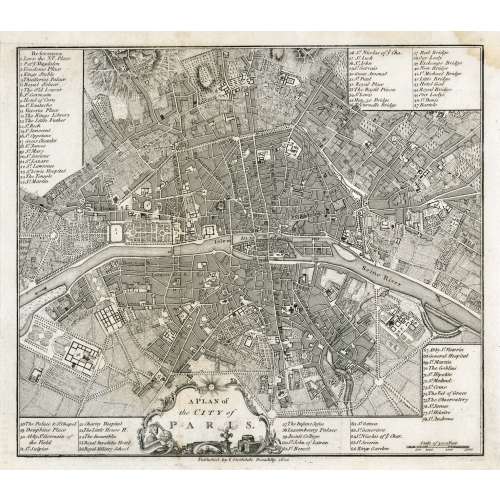 In pictorial frame: A PLAN of | the CITY of PARIS. || Under the border: Published by I. Stockdale Piccadilly 1800 || Dimensions: Sheet: 29 x 34.5 cm; Image: 22.7 x 25.9 cm.
 -
 Top: THE ENVIRONS OF PARIS. || Bottom centre: Published by Baldwin & Cradock, Paternoster Row, | Under the Superintendence of the Society for the Diffusion of Useful Knowledge. | March 1st. 1832. || Bottom right: J. & C. Walker sculpt. || Dimensions: Sheet: 34.7 x 40.5 cm; Image: 30 x 37 cm. Contributors: J & C Walker (British firm, fl. 1820 – 1895) Walker, John (British, 1787 – 1873) Walker, Alexander (British, 1797? – 1870) Walker, Charles (British, 1799? – 1872) Society for the Diffusion of Useful Knowledge (SDUK) (British firm, 1826 – 1846)
 -
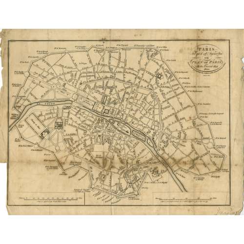 Title: PARIS | Tel qu'il est Aujourd'hui | OR | PLAN OF PARIS | At the Present day. 1800 | From a Drawing deposited in the Archieves of the National Library at Paris | Menzies sculpt. || Contributor: Menzies, John (British, fl. c. 1792 – 1851) – engraver. Ref: Gallica.
 -
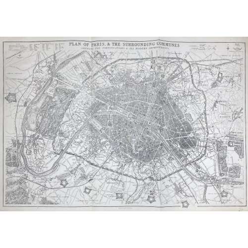 PLAN OF PARIS & THE SURROUNDING COMMUNES | SHEWING THE FORTIFICATIONS & ALL MODERN IMPROVEMENTS. || Lettered above the image with title, and below with production detail: "Day & Son, Lithrs to the Queen"; and production detail above: "Drawn & Engraved by B.R. Davies: / 16 George Str Euston Squ London", and on top right: "Weekly Dispatch Atlas, 138 Fleet Str". Dimensions: 47.5 x 65.4 cm. Contributors: Day & Son; William Day (British, 1797 – 1845) – lithographer, printer. Davies, Benjamin Rees (British, 1789 – 1872) – artist, engraver.
 -
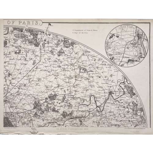 Four maps 34 x 47.5 cm each. Include insets of Versailles, Fontainebleau, Saint Cloud and St. Germain en Laye. Lithograph by Edward Weller after a map drawn and engraved by John Dower. "These maps originally appeared in the Weekly Dispatch newspaper from 1856 to 1862. They were reissued between 1863 and 1867 by Cassell, Petter and Galpin and then published collectively as Cassell's Atlas. The plates were acquired by G.W. Bacon & Co., and reissued in 1876 under the title Bacon's New Quarto Atlas ... of the Counties of England, and many times since under various titles." [WorldCat]
Dimensions: 34 x 47.5 cm each.
Contributors: Weller, Edward (British, 1819 – 1884) – lithographer. Dower, John Crane (British, 1791 – 1847) – artist, engraver. Dower, John James (British, 1825 – 1901) – artist, engraver (son of John Crane Dower). -
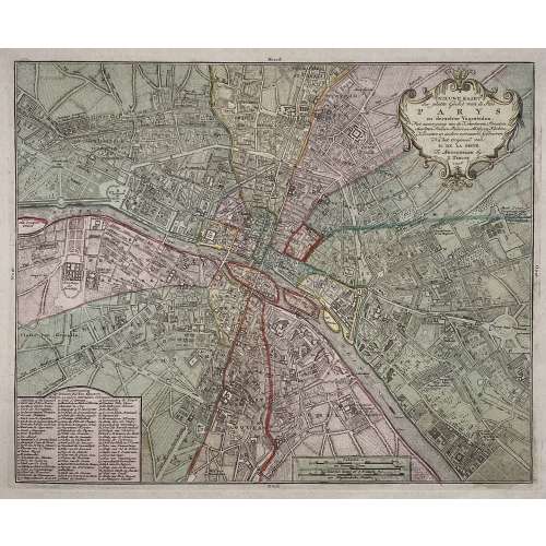
Title: NIEUWE KAART | der platte Grond van de Stad | PARYS | en derzelver Voorsteden. | Met aanwyzing van de Kwartieren, Staaten, | Markten, Pleinen, Paleizen, Abtyden, Kerken, | Kloosters en andere voornaame Gebouwen. | Na het Origineel van | M. DE LA GRIVE. | Te Amsterdam by | I. Tirion. | 1756. ||
Author : Jean Delagrive (French, 1689-1757)
Publisher: Isaak Tirion (Dutch, 1705 – 1765)
Publication date: 1756.
Dimensions: Sheet: 42.5 x 53.8 cm; Image: 30.7 x 37.7 cm.
Plate № 59 from Beknopte Atlas van omtrent honderd platte gronden der voornaamste vestingen, kasteelen en Steden van Europa.


