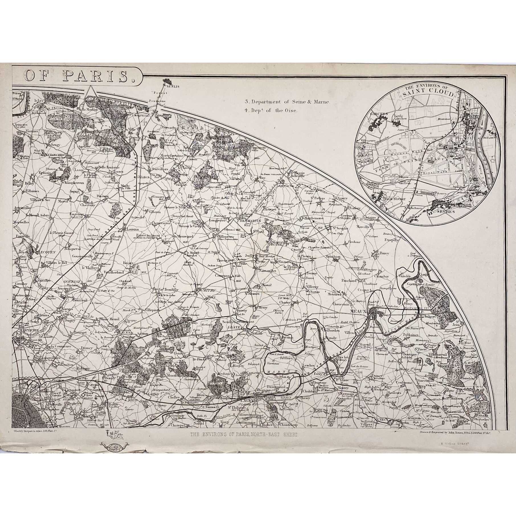
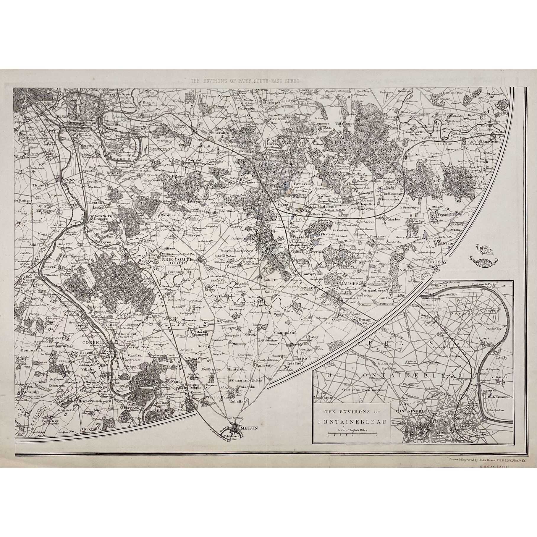
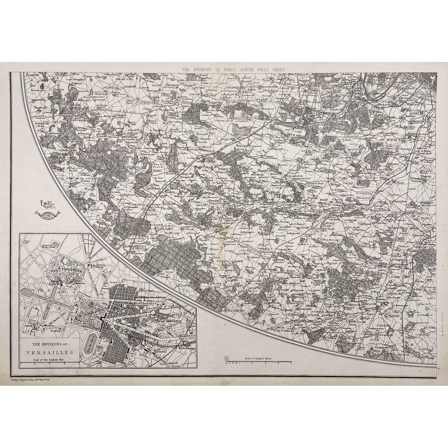
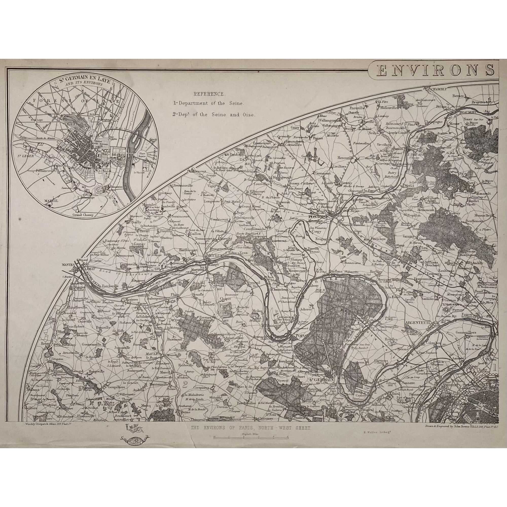
Four maps 34 x 47.5 cm each. Include insets of Versailles, Fontainebleau, Saint Cloud and St. Germain en Laye. Lithograph by Edward Weller after a map drawn and engraved by John Dower.
"These maps originally appeared in the Weekly Dispatch newspaper from 1856 to 1862. They were reissued between 1863 and 1867 by Cassell, Petter and Galpin and then published collectively as Cassell's Atlas. The plates were acquired by G.W. Bacon & Co., and reissued in 1876 under the title Bacon's New Quarto Atlas ... of the Counties of England, and many times since under various titles." [WorldCat]
Dimensions: 34 x 47.5 cm each.
Contributors:
Weller, Edward (British, 1819 – 1884) – lithographer.
Dower, John Crane (British, 1791 – 1847) – artist, engraver.
Dower, John James (British, 1825 – 1901) – artist, engraver (son of John Crane Dower).
Additional Information
| Collection | European prints and drawings |
|---|---|
| Type / Purpose | Map |
| Period | 19 AD , Mid-19th century |
| Country | Great Britain |
| Language | English |
| Subject | Cities and towns , City , Early maps , Paris , Physical maps , World atlases |
| Material | Wove paper |
| Media/Technique | Lithography |
| Creation / Publishing year | 1863 |
| Acquisition year | 2021 |
Related Items


SVVP-0073.2021
The environs of Paris. — London: Baldwin & Cradock, 1832.

SVVP-0074.2021
A plan of the city of Paris. — London: J. Stockdale, 1800.

SVVP-0076.2021
Eastern division of Paris. — Edward Stanford, c. 1870.

