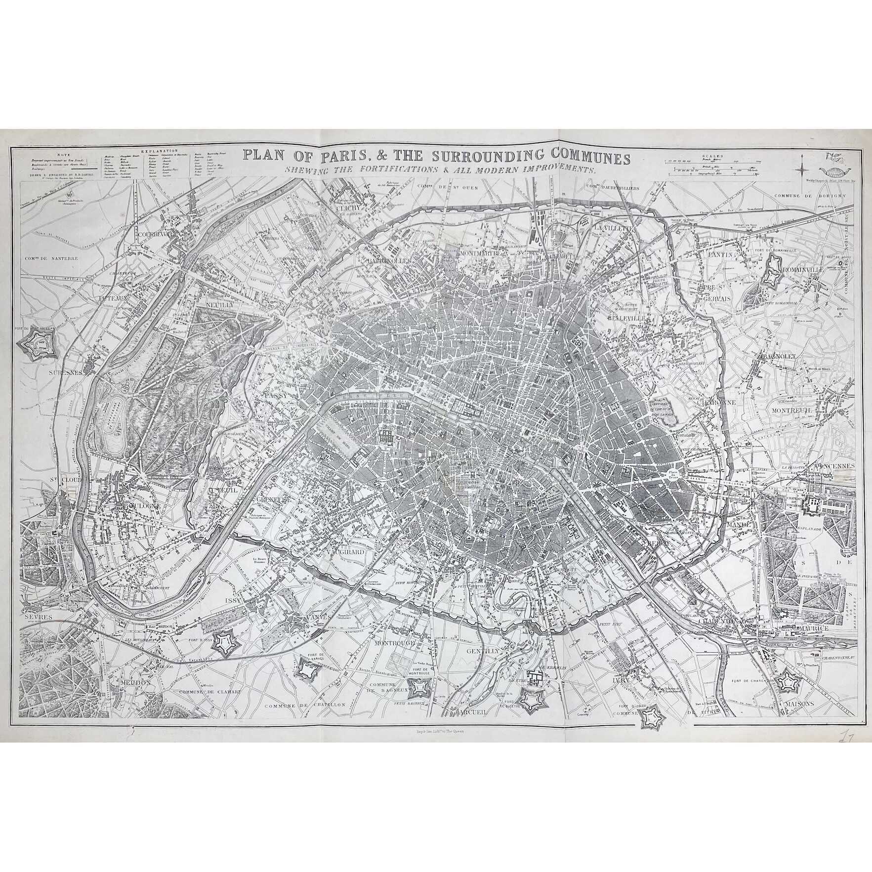
PLAN OF PARIS & THE SURROUNDING COMMUNES | SHEWING THE FORTIFICATIONS & ALL MODERN IMPROVEMENTS. ||
Lettered above the image with title, and below with production detail: "Day & Son, Lithrs to the Queen"; and production detail above: "Drawn & Engraved by B.R. Davies: / 16 George Str Euston Squ London", and on top right: "Weekly Dispatch Atlas, 138 Fleet Str".
Dimensions: 47.5 x 65.4 cm.
Contributors:
Day & Son; William Day (British, 1797 – 1845) – lithographer, printer.
Davies, Benjamin Rees (British, 1789 – 1872) – artist, engraver.
Additional Information
| Collection | European prints and drawings |
|---|---|
| Type / Purpose | Map |
| Period | 19 AD , Mid-19th century |
| Country | Great Britain |
| Language | English |
| Subject | Cities and towns , City , Early maps , Paris , Physical maps , World atlases |
| Material | Wove paper |
| Media/Technique | Lithography |
| Creation / Publishing year | 1863 |
| Acquisition year | 2021 |
Related Items


SVVP-0073.2021
The environs of Paris. — London: Baldwin & Cradock, 1832.

SVVP-0074.2021
A plan of the city of Paris. — London: J. Stockdale, 1800.

SVVP-0076.2021
Eastern division of Paris. — Edward Stanford, c. 1870.

