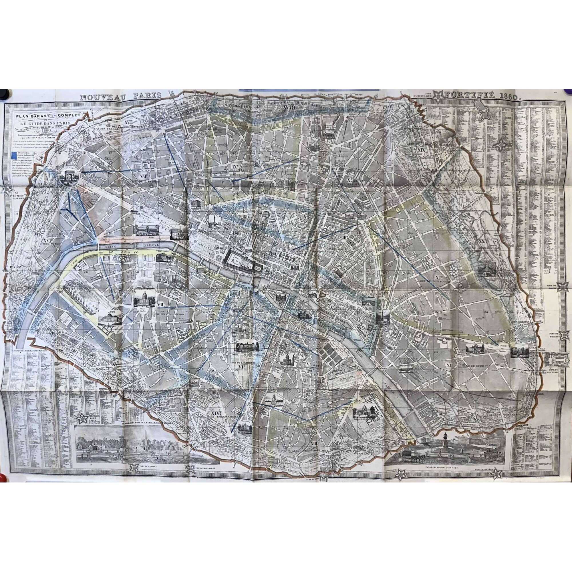
A folding pocket map of Paris, 620 x 890 mm, hand-coloured, folded size: 168 x 102 mm. A high-quality image at Wikimedia Commons.
Description by seller: "Contours des arrondissements et mur des fortifications aquarellés. Les arrondissements nouvellement annexés ne sont pas reproduits à l'échelle. Avec indication en bleu des percements haussmaniens en cours. Deux panoramas gravés en marge".
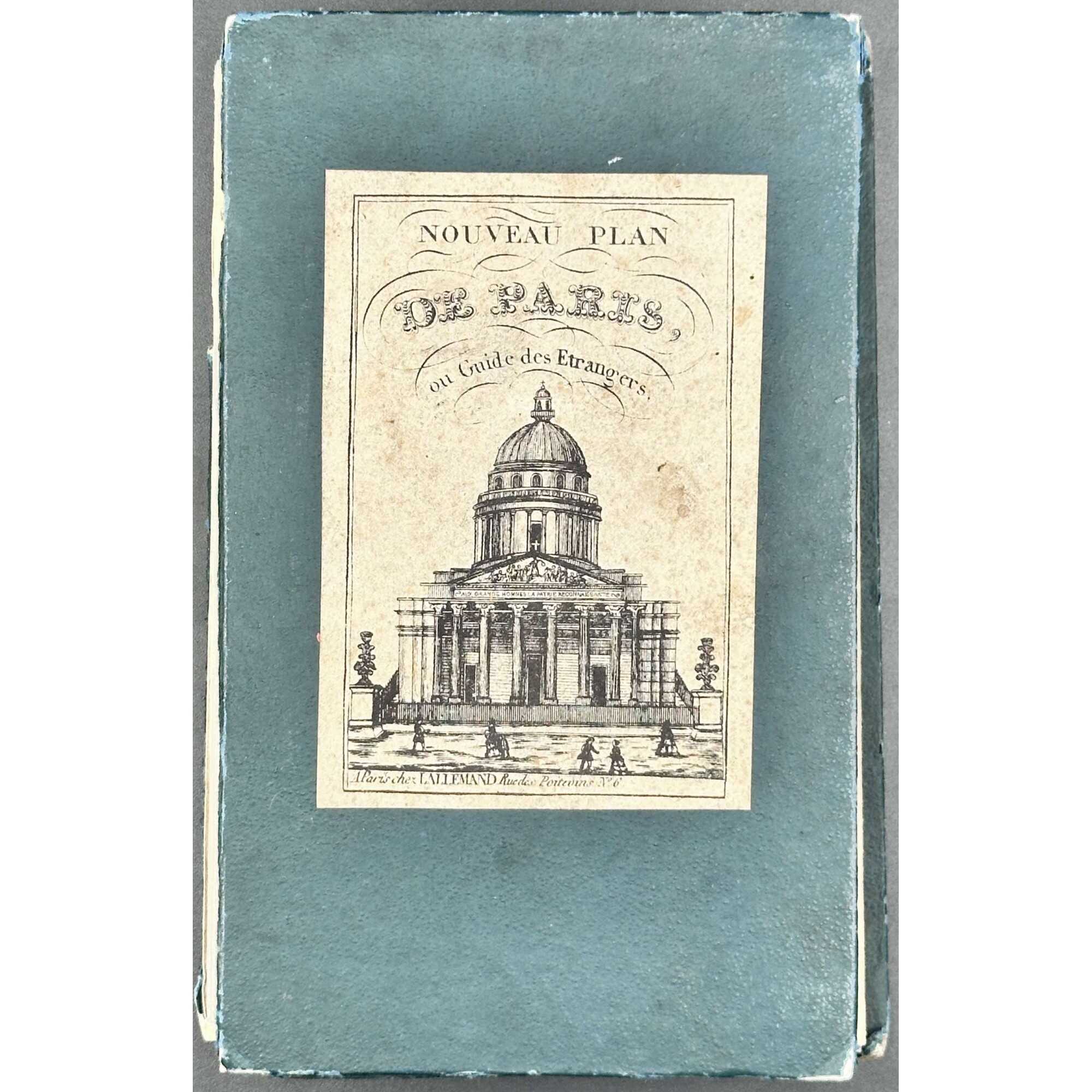
Label: NOUVEAU PLAN | DE PARIS, | ou Guide des Étrangers. | {Panthéon} | A Paris chez LALLEMAND Rue de Poitevins No. 6.
Title: NOUVEAU PARIS [—] FORTIFIÉ 1860. || PLAN GARANTI~COMPLET | OU | LE GUIDE DAN PARIS | DRESSÉ | PAR LALLEMAND, GÉOGRPHE. GRAV. AU DÉPOT DE LA GUERRE | 1860 | A Paris Rue de Poitevins No. 6.
Engraver: Dépôt de la guerre
Publisher/Cartographer: Lallemand, Armand Joseph (French, c.1810 – 1871)
Additional Information
| Collection | French history, art, literature , Paris |
|---|---|
| Type / Purpose | Map |
| Period | 19 AD , Mid-19th century |
| Country | France |
| Language | French |
| Subject | Cities and towns , City , France , Paris , Physical maps |
| Material | Paper |
| Creation / Publishing year | 1859 |
| Location | BOX 39. |
| Acquisition year | 2024 |


